Kiribati Vector EPS maps
EPSmaps.com offers a wide range of digital map collections for businesses in Adobe Illustrator EPS format. These maps are designed to provide accurate and detailed information about various countries and regions around the world. One such collection is the Kiribati Vector EPS maps.
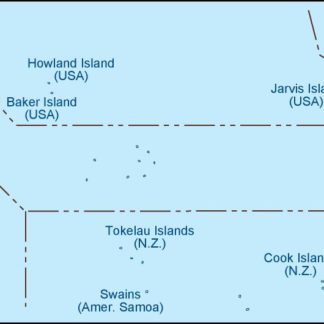
Kiribati is a small island nation located in the central Pacific Ocean. It is made up of 33 coral atolls and islands, with a total land area of just over 800 square kilometers. Despite its small size, Kiribati is an important country in the region, with a unique culture and history.
The Kiribati Vector EPS maps available on EPSmaps.com provide detailed information about the country’s geography, including its islands, atolls, and surrounding waters. They also include important information about the country’s major cities and towns, as well as its transportation infrastructure, such as airports and seaports.
These maps are designed to be highly accurate and up-to-date, making them an essential tool for businesses operating in Kiribati. Whether you are looking to expand your business in the country or simply need accurate information about its geography and infrastructure, the Kiribati Vector EPS maps available on EPSmaps.com are an invaluable resource.
Showing all 4 resultsSorted by latest
-

kiribati illustrator eps map vector
29.00 € Select options -
kiribati political eps map vector
99.00 € Select options -
kiribati blind eps map vector
35.00 € Select options -
kiribati eps map vector
39.00 € Select options


Showing all 4 resultsSorted by latest