Belarus Vector EPS maps
Belarus Vector EPS maps are a collection of digital maps created using Adobe Illustrator software. These maps are designed to provide accurate and detailed information about the geography, cities, and important landmarks of Belarus.
Belarus is a landlocked country located in Eastern Europe, bordered by Russia to the east and northeast, Ukraine to the south, Poland to the west, and Lithuania and Latvia to the northwest. The country has a population of approximately 9.5 million people and its capital city is Minsk.
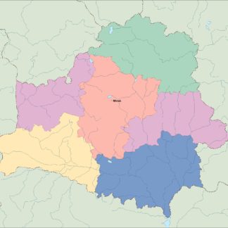
The Belarus Vector EPS maps include detailed information about the major cities in the country, such as Minsk, Brest, Gomel, Grodno, Mogilev, and Vitebsk. These maps also provide information about the country’s major rivers, lakes, and other important landmarks.
The maps are designed to be easy to use and customizable, allowing users to add their own information and data to the maps. They are ideal for use in a variety of applications, including education, tourism, and business.
Overall, the Belarus Vector EPS maps are an essential tool for anyone looking to explore or do business in Belarus. They provide accurate and detailed information about the country’s geography, cities, and important landmarks, making them an invaluable resource for anyone looking to navigate the country.
Showing all 6 results
-

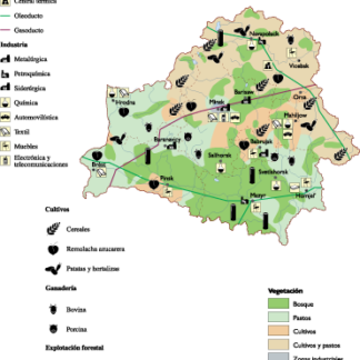
Belarus Economic eps map vector
75.00 € Select options -

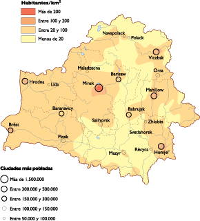
Belarus Population eps map vector
60.00 € Select options -
belarus illustrator eps map vector
29.00 € Select options -
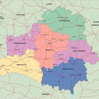
belarus political eps map vector
99.00 € Select options -
belarus blind eps map vector
35.00 € Select options -
belarus eps map vector
39.00 € Select options

Showing all 6 results