Bangladesh Vector EPS maps
Welcome to EPSmaps.com, your go-to source for high-quality digital maps in Adobe Illustrator EPS format. Our collection includes maps for various countries, including Bangladesh.
Our Bangladesh Vector EPS maps are designed to provide businesses with accurate and detailed information about the country’s geography, cities, and other important features. These maps are perfect for use in presentations, marketing materials, and other business applications.
Our Bangladesh Vector EPS maps include detailed information about the country’s major cities, including Dhaka, Chittagong, and Khulna. These maps also provide information about important landmarks, such as the Sundarbans mangrove forest and the Cox’s Bazar beach.
In addition to providing information about cities and landmarks, our Bangladesh Vector EPS maps also include information about the country’s geography and topography. This includes information about rivers, mountains, and other natural features.
Our Bangladesh Vector EPS maps are designed to be easy to use and customize. They can be easily edited in Adobe Illustrator, allowing businesses to add their own branding and other customizations.
Overall, our Bangladesh Vector EPS maps are an essential tool for any business looking to expand their operations in Bangladesh. With accurate and detailed information about the country’s geography, cities, and other important features, these maps are sure to help businesses make informed decisions and achieve their goals.
Showing all 5 results
-

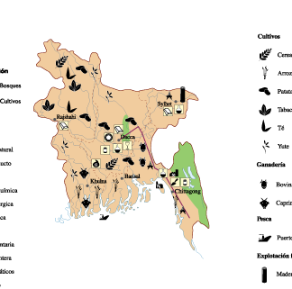
Bangladesh Economic eps map vector
75.00 € Select options -

bangladesh illustrator eps map vector
29.00 € Select options -
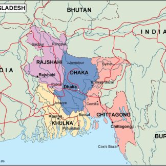
bangladesh political eps map vector
99.00 € Select options -
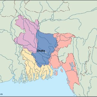
bangladesh blind eps map vector
35.00 € Select options -
bangladesh eps map vector
39.00 € Select options


Showing all 5 results