Iran Vector EPS maps
EPSmaps.com offers a wide range of digital map collections for businesses in Adobe Illustrator EPS format. Our collection includes maps of various countries, including Iran Vector EPS maps.
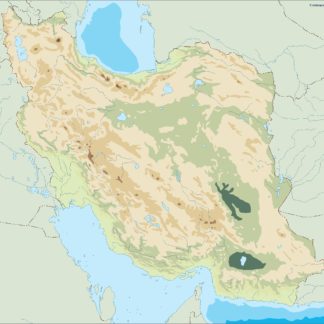
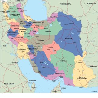
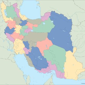
Our Iran Vector EPS maps are highly detailed and accurate, providing businesses with a comprehensive view of the country’s geography. These maps include important cities, landmarks, and geographical features, making them an essential tool for businesses operating in Iran.
Iran is located in Western Asia and is the 18th largest country in the world. It is bordered by Iraq, Turkey, Armenia, Azerbaijan, Turkmenistan, Afghanistan, and Pakistan. The capital city of Iran is Tehran, which is also the country’s largest city. Other important cities in Iran include Mashhad, Isfahan, and Shiraz.
Our Iran Vector EPS maps also include important geographical features such as the Caspian Sea, the Zagros Mountains, and the Persian Gulf. These features are essential for businesses operating in Iran, as they can impact transportation and logistics.
Overall, our Iran Vector EPS maps are an essential tool for businesses operating in Iran. They provide a comprehensive view of the country’s geography, including important cities and landmarks, and can help businesses navigate the country’s unique terrain and transportation challenges.
Showing all 8 resultsSorted by latest
-

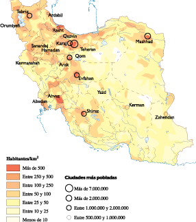
Iran Population eps map vector
60.00 € Select options -

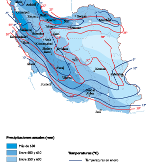
Iran Climate eps map vector
65.00 € Select options -

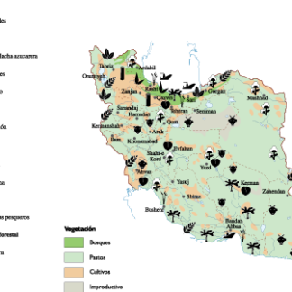
Iran Agricultural eps map vector
70.00 € Select options -
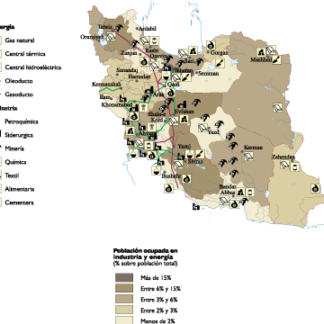
Iran Economic eps map vector
75.00 € Select options -
iran illustrator eps map vector
29.00 € Select options -
iran political eps map vector
99.00 € Select options -
iran blind eps map vector
35.00 € Select options -
iran eps map vector
39.00 € Select options

Showing all 8 resultsSorted by latest