Djibouti Vector EPS maps
Our collection of digital maps in Adobe Illustrator EPS format includes maps of Djibouti. These maps are highly detailed and accurate, providing users with a comprehensive view of the country’s geography, topography, and infrastructure.
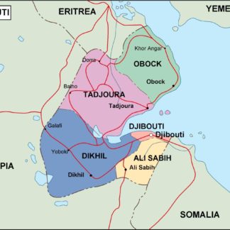
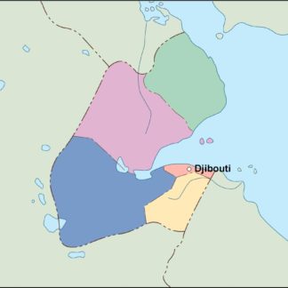
Djibouti is a small country located in the Horn of Africa, bordered by Eritrea to the north, Ethiopia to the west and south, and Somalia to the southeast. The country has a population of approximately 1 million people and its capital city is Djibouti City.
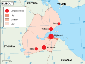
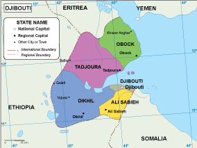
Our Djibouti Vector EPS maps include detailed information about the country’s major cities, including Djibouti City, Tadjourah, and Obock. These maps also highlight important landmarks and features, such as the Gulf of Aden, Lake Assal, and the Danakil Desert.
Whether you are a traveler, researcher, or business professional, our collection of digital maps in Adobe Illustrator EPS format provides you with the tools you need to explore and understand Djibouti. With high-quality graphics and detailed information, these maps are an essential resource for anyone interested in this fascinating country.
Showing all 10 resultsSorted by latest
-

Djibouti physical eps map vector
50.00 € Select options -
Djibouti transportation eps map vector
55.00 € Select options -
Djibouti population eps map vector
60.00 € Select options -
Djibouti EPS map vector
80.00 € Select options -
Djibouti economic eps map vector
75.00 € Select options -
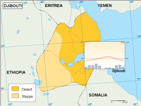
Djibouti climate eps map vector
65.00 € Select options -

djibouti illustrator eps map vector
29.00 € Select options -
djibouti political eps map vector
99.00 € Select options -
djibouti blind eps map vector
35.00 € Select options -
djibouti eps map vector
39.00 € Select options


Showing all 10 resultsSorted by latest