Burundi Vector EPS maps
Burundi is a small landlocked country located in East Africa. It is bordered by Tanzania to the east and south, Rwanda to the north, and the Democratic Republic of the Congo to the west. Burundi is known for its beautiful landscapes, including mountains, lakes, and forests.
Our collection of Burundi vector EPS maps includes detailed maps of the country, including its major cities and towns. These maps are created using Adobe Illustrator, a powerful vector graphics software that allows for high-quality, scalable images.
Our Burundi vector EPS maps are perfect for a variety of uses, including educational materials, travel guides, and business presentations. They are easy to customize and can be used to highlight specific areas of the country, such as tourist attractions or important landmarks.
Whether you are planning a trip to Burundi or simply want to learn more about this fascinating country, our collection of vector EPS maps is an excellent resource. With detailed information on the country’s geography, cities, and landmarks, these maps are an essential tool for anyone interested in Burundi.
Showing all 11 results
-

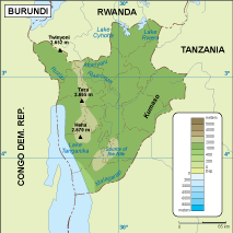
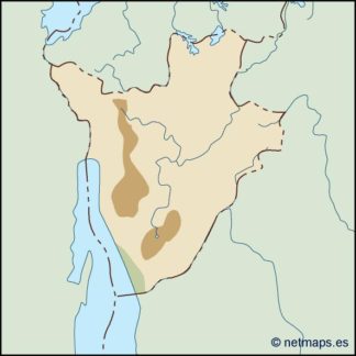
Burundi physical eps map vector
50.00 € Select options -
Burundi transportation eps map vector
55.00 € Select options -

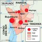
Burundi population eps map vector
60.00 € Select options -
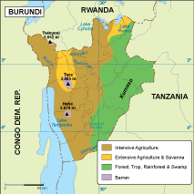
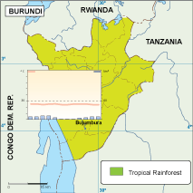
Burundi vegetation eps map vector
70.00 € Select options -
Burundi EPS map vector
80.00 € Select options -
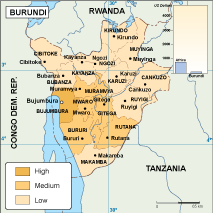
Burundi economic eps map vector
75.00 € Select options -
Burundi climate eps map vector
65.00 € Select options -

burundi illustrator eps map vector
29.00 € Select options -
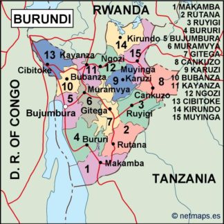
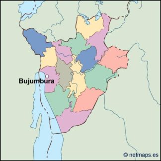
burundi political eps map vector
99.00 € Select options -
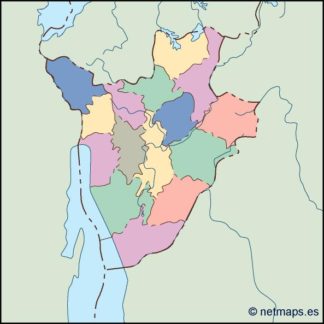
burundi blind eps map vector
35.00 € Select options -
burundi eps map vector
39.00 € Select options

Showing all 11 results