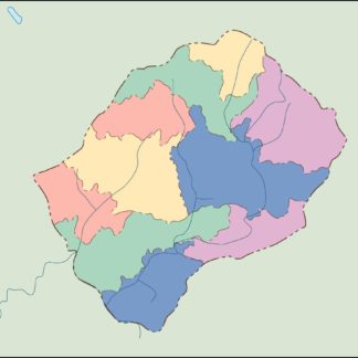
Lesotho Vector EPS maps
Our collection of digital maps in Adobe Illustrator EPS format includes maps of Lesotho. These maps are highly detailed and accurate, providing users with a comprehensive view of the country’s geography, topography, and infrastructure.
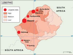
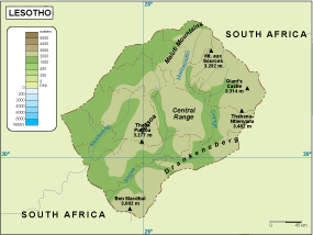
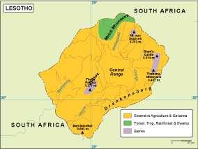
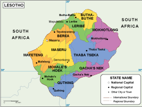
Lesotho is a landlocked country located in southern Africa. It is surrounded by South Africa and is known for its mountainous terrain, which covers over 80% of the country. The capital city is Maseru, which is located in the western part of the country.
Our Lesotho Vector EPS maps include detailed information about the country’s major cities, towns, and landmarks. This includes information about the location of important government buildings, hospitals, schools, and other key institutions.
In addition to providing information about the country’s infrastructure, our maps also highlight important natural features such as rivers, lakes, and mountains. This information is useful for a variety of purposes, including tourism, research, and planning.
Overall, our collection of Lesotho Vector EPS maps is an essential resource for anyone looking to explore or understand this fascinating country. With their high level of detail and accuracy, these maps are an invaluable tool for researchers, educators, and travelers alike.
Showing all 11 results
-

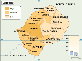
Lesotho Population eps map vector
60.00 € Select options -

Lesotho physical eps map vector
50.00 € Select options -
Lesotho transportation eps map vector
55.00 € Select options -
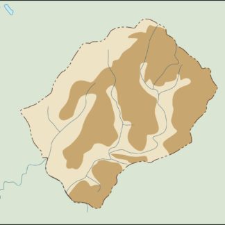
Lesotho vegetation eps map vector
70.00 € Select options -
Lesotho EPS map vector
80.00 € Select options -
Lesotho economic eps map vector
75.00 € Select options -
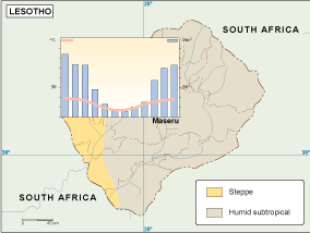
Lesotho climate eps map vector
65.00 € Select options -

lesotho illustrator eps map vector
29.00 € Select options -
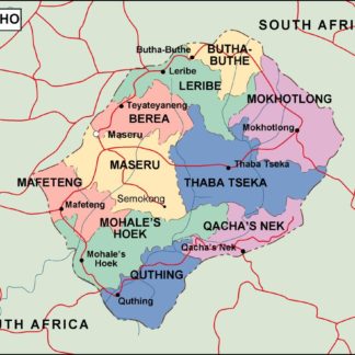
lesotho political eps map vector
99.00 € Select options -
lesotho blind eps map vector
35.00 € Select options -
lesotho eps map vector
39.00 € Select options

Showing all 11 results