Description
Australia and Oceania Vector Maps. EPS illustrator map from our Oceania country database. All our digital cartography was created via Adobe Illustrator
Vector eps City maps of the cities and countries of the world. More than 10 000 vector files
39.00 €
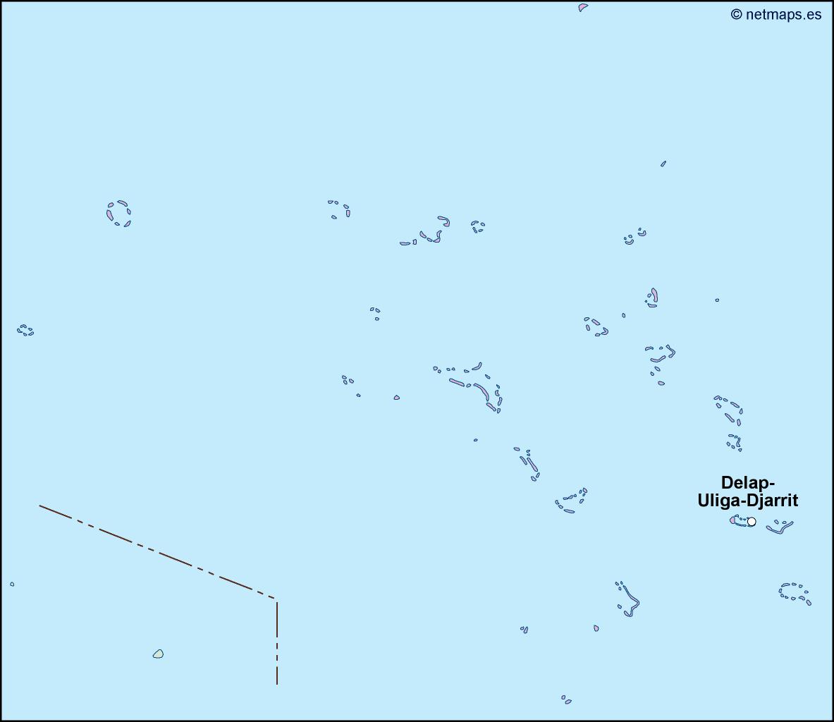
The Marshall Islands is a small island nation located in the Pacific Ocean. It is made up of 29 coral atolls and 5 single islands, and is situated between Hawaii and Australia. The capital city of the Marshall Islands is Majuro, which is located on the atoll of the same name.
The Marshall Islands is a unique and beautiful country, with a rich culture and history. It is known for its stunning beaches, crystal-clear waters, and abundant marine life. The islands are also home to a number of important historical sites, including World War II battlefields and nuclear test sites.
If you are looking to create an EPS vector map of the Marshall Islands, there are a few key features that you will want to include. First and foremost, you will want to make sure that the map accurately depicts the location of the country within its larger geographic context. This means including neighboring countries and bodies of water, as well as the equator and other important geographic features.
Once you have established the broader context of the map, you can begin to focus on the details of the Marshall Islands themselves. This will likely involve creating a detailed outline of the country’s 29 atolls and 5 single islands, as well as labeling each of these features with their respective names.
In addition to the physical features of the country, you may also want to include other important information on your EPS vector map. This could include the location of major cities and towns, as well as important landmarks and historical sites. You may also want to include information about the country’s population, economy, and other key statistics.
Overall, creating an EPS vector map of the Marshall Islands can be a challenging but rewarding task. By paying close attention to the details of the country’s geography and culture, you can create a map that accurately reflects the unique character and beauty of this fascinating island nation.
Australia and Oceania Vector Maps. EPS illustrator map from our Oceania country database. All our digital cartography was created via Adobe Illustrator