Description
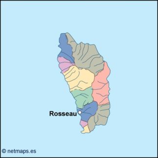
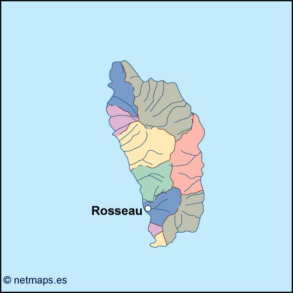
dominica vector map. Vector maps from Central America and Caribe Illustrator EPS files, fully editable from our American Country map database. All our digital cartography was created with Vector Adobe Illustrator
Vector eps City maps of the cities and countries of the world. More than 10 000 vector files
39.00 €
The Dominican Republic is a beautiful country located in the Caribbean region of North America. Its capital is Santo Domingo, which is also the largest city in the country. The Dominican Republic is bordered by Haiti to the west and the Atlantic Ocean to the north and south. The country covers an area of approximately 48,442 square kilometers and has a population of over 10 million people.
The Dominican Republic is known for its beautiful beaches, lush tropical forests, and vibrant culture. The country is a popular tourist destination, attracting millions of visitors each year. The country’s economy is largely based on tourism, agriculture, and manufacturing.
The EPS vector illustrator map of the Dominican Republic is a detailed representation of the country’s geography. The map includes all major cities, towns, and villages, as well as major highways, rivers, and mountains. The map is designed to be used for a variety of purposes, including tourism, education, and business.
The map is divided into several regions, each with its own unique characteristics. The northern region of the country is known for its beautiful beaches and lush tropical forests. The central region is home to the country’s capital, Santo Domingo, as well as several other major cities and towns. The eastern region is known for its beautiful beaches and is a popular tourist destination.
The map also includes several important landmarks and attractions, including the Alcazar de Colon, the Cathedral of Santa Maria la Menor, and the National Palace. These landmarks are important cultural and historical sites that attract visitors from all over the world.
The EPS vector illustrator map of the Dominican Republic is designed to be easy to use and navigate. The map is available in a variety of formats, including PDF, JPEG, and EPS. The map can be customized to meet the needs of any user, whether they are a tourist, educator, or business owner.
Overall, the EPS vector illustrator map of the Dominican Republic is an essential tool for anyone interested in exploring this beautiful country. Whether you are planning a vacation, conducting business, or studying the country’s geography and culture, this map is an invaluable resource.
dominica vector map. Vector maps from Central America and Caribe Illustrator EPS files, fully editable from our American Country map database. All our digital cartography was created with Vector Adobe Illustrator