Description
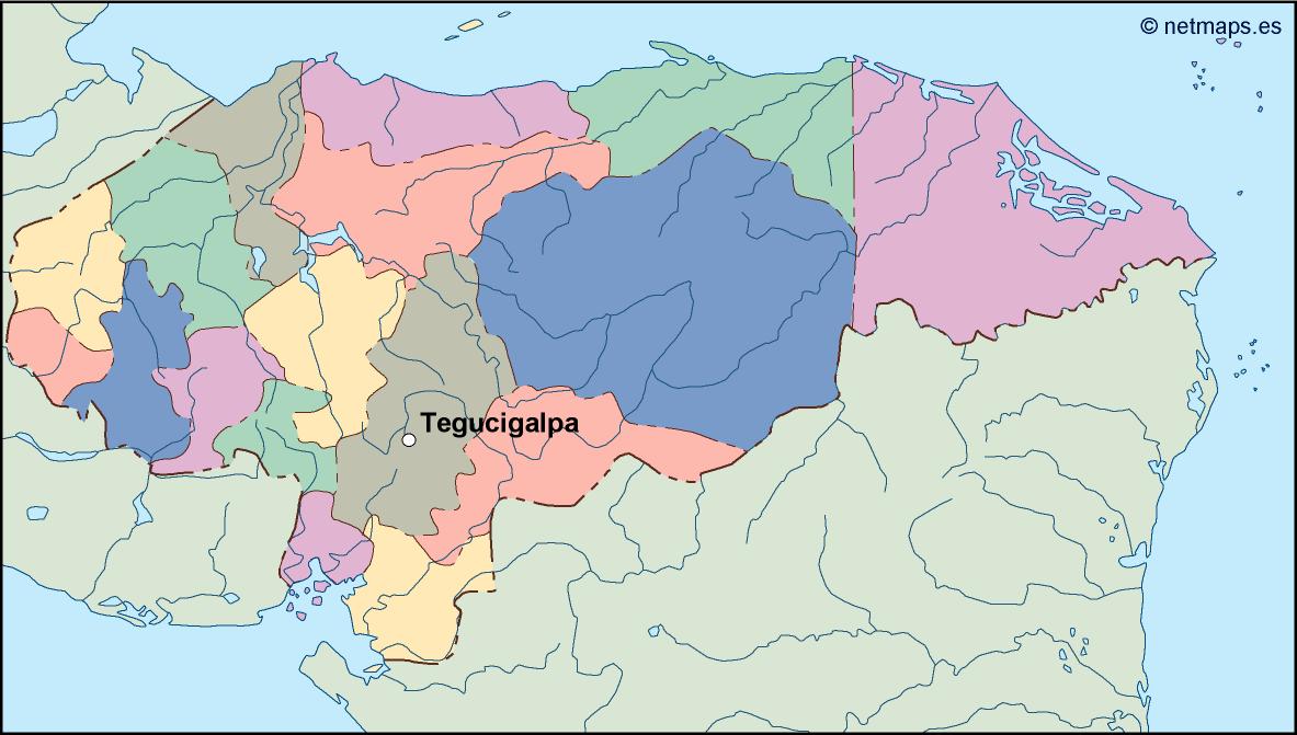
honduras vector map. Vector maps from Central America and Caribe Illustrator EPS files, fully editable from our American Country map database. All our digital cartography was created with Vector Adobe Illustrator
Vector eps City maps of the cities and countries of the world. More than 10 000 vector files
39.00 €
illustrator for sale.
This EPS vector illustrator map depicts the country of Honduras, located in Central America. The capital city, Tegucigalpa, is marked on the map. The country is bordered by Guatemala to the northwest, El Salvador to the southwest, Nicaragua to the southeast, the Pacific Ocean to the south, and the Caribbean Sea to the north. The map includes major cities, rivers, lakes, and mountain ranges. The vector format allows for easy customization and scaling to any size without loss of quality. This map is perfect for use in educational materials, travel guides, and business presentations.
honduras vector map. Vector maps from Central America and Caribe Illustrator EPS files, fully editable from our American Country map database. All our digital cartography was created with Vector Adobe Illustrator