Europe Population Maps
Our collection of digital maps in Adobe Illustrator EPS format includes a wide range of maps for various countries and regions around the world. One of our most popular collections is the Europe Population Maps, which provides detailed information on the population distribution and density across the continent.
These maps are designed to be highly accurate and informative, with clear and easy-to-read labels and symbols that highlight important cities, towns, and other landmarks. They also include detailed information on the location and size of major rivers, lakes, and other natural features, as well as important transportation routes such as highways, railways, and airports.
In addition to providing valuable information on population density and distribution, these maps can also be used for a variety of other purposes, such as planning and development, marketing and advertising, and educational and research purposes. They are also highly customizable, allowing users to add their own data and information to the maps as needed.
Overall, our collection of digital maps in Adobe Illustrator EPS format is an invaluable resource for anyone looking to explore and understand the world around them. Whether you are a student, researcher, business owner, or simply a curious traveler, these maps are sure to provide you with the information and insights you need to make informed decisions and explore new opportunities.
Showing 1–16 of 35 resultsSorted by latest
-

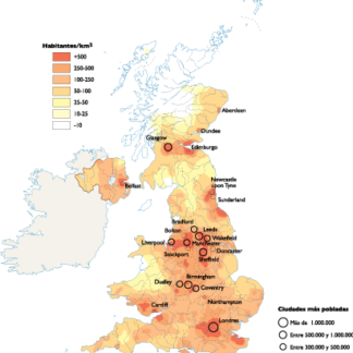
United Kingdom Population eps map vector
60.00 € Select options -
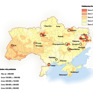
Ukraine Population eps map vector
60.00 € Select options -
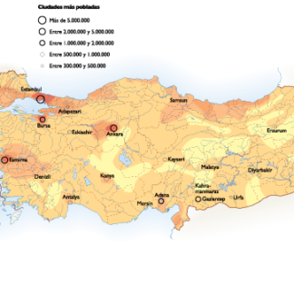
Turkey Population eps map vector
60.00 € Select options -

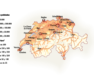
Switzerland Population eps map vector
60.00 € Select options -

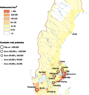
Sweden Population eps map vector
60.00 € Select options -

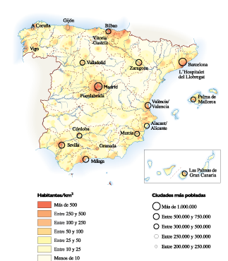
Spain Population eps map vector
60.00 € Select options -
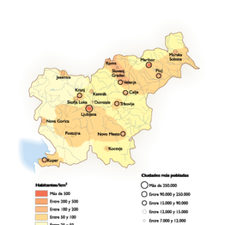
Slovenia Population eps map vector
60.00 € Select options -

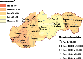
Slovak Republic Population eps map vector
60.00 € Select options -
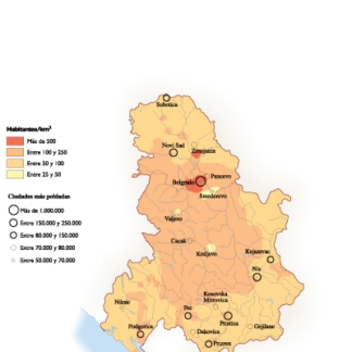
Serbia Population eps map vector
60.00 € Select options -
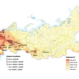
Russia Population eps map vector
60.00 € Select options -

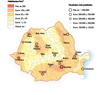
Romania Population eps map vector
60.00 € Select options -

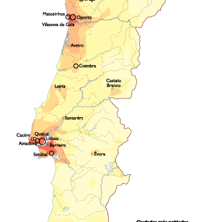
Portugal Population eps map vector
60.00 € Select options -
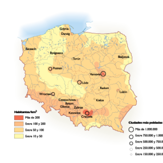
Poland Population eps map vector
60.00 € Select options -

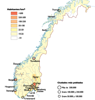
Norway Population eps map vector
60.00 € Select options -
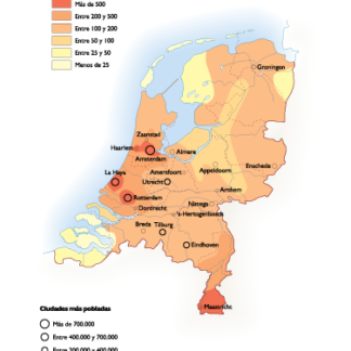
Netherlands Population eps map vector
60.00 € Select options -
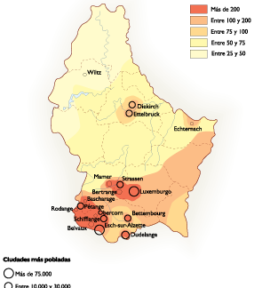
Luxembourg Population eps map vector
60.00 € Select options
Showing 1–16 of 35 resultsSorted by latest