Europe Economic Maps
Our collection of digital maps in Adobe Illustrator EPS format includes a wide range of maps for various countries around the world. In particular, our Europe Economic Maps collection features detailed maps of European countries, highlighting important cities and regions.
Each map in our collection is created using the latest GIS data, ensuring accuracy and precision. Our maps are designed to be easily editable, allowing you to customize them to suit your specific needs. Whether you’re creating a presentation, designing a website, or printing a brochure, our maps are the perfect tool for showcasing important information about a particular country or region.
Our Europe Economic Maps collection includes maps of countries such as Germany, France, Italy, Spain, and the United Kingdom, among others. Each map features important cities, landmarks, and regions, as well as key economic data such as GDP, population, and industry sectors.
Whether you’re a business owner, researcher, or student, our collection of digital maps in Adobe Illustrator EPS format is an invaluable resource for understanding the economic landscape of Europe. With our detailed and accurate maps, you can easily visualize and analyze important economic data for any country in the region.
Showing 1–16 of 41 resultsSorted by latest
-

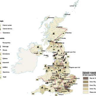
United Kingdom Economic eps map vector
75.00 € Select options -
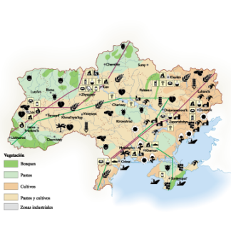
Ukraine Economic eps map vector
75.00 € Select options -
Turkey Economic eps map vector
75.00 € Select options -
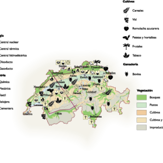
Switzerland Economic eps map vector
75.00 € Select options -
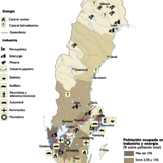
Sweden Economic eps map vector
75.00 € Select options -
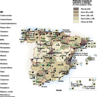
Spain Economic eps map vector
75.00 € Select options -
Slovenia Economic eps map vector
75.00 € Select options -

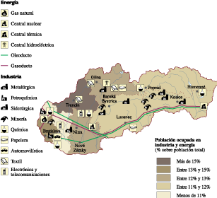
Slovak Republic Economic eps map vector
75.00 € Select options -
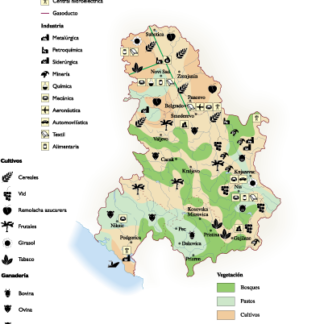
Serbia Economic eps map vector
75.00 € Select options -
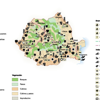
Romania Economic eps map vector
75.00 € Select options -
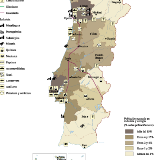
Portugal Economic eps map vector
75.00 € Select options -

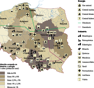
Poland Economic eps map vector
75.00 € Select options -

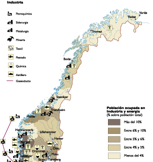
Norway Economic eps map vector
75.00 € Select options -
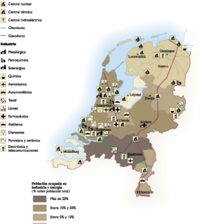
Netherlands Economic eps map vector
75.00 € Select options -
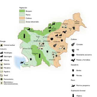
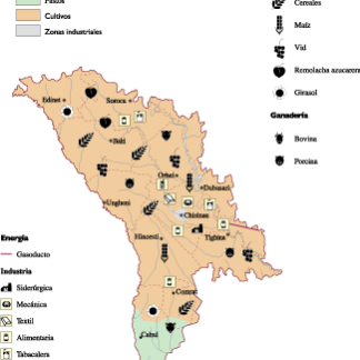
Moldova Economic eps map vector
75.00 € Select options -
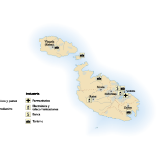
Malta Economic eps map vector
75.00 € Select options

Showing 1–16 of 41 resultsSorted by latest