Description
bulgaria vector map. Vector maps from Europe. Illustrator EPS files, fully editable from our european Country map database. All our digital cartography was created with Vector Adobe Illustrator
Vector eps City maps of the cities and countries of the world. More than 10 000 vector files
39.00 €
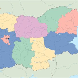
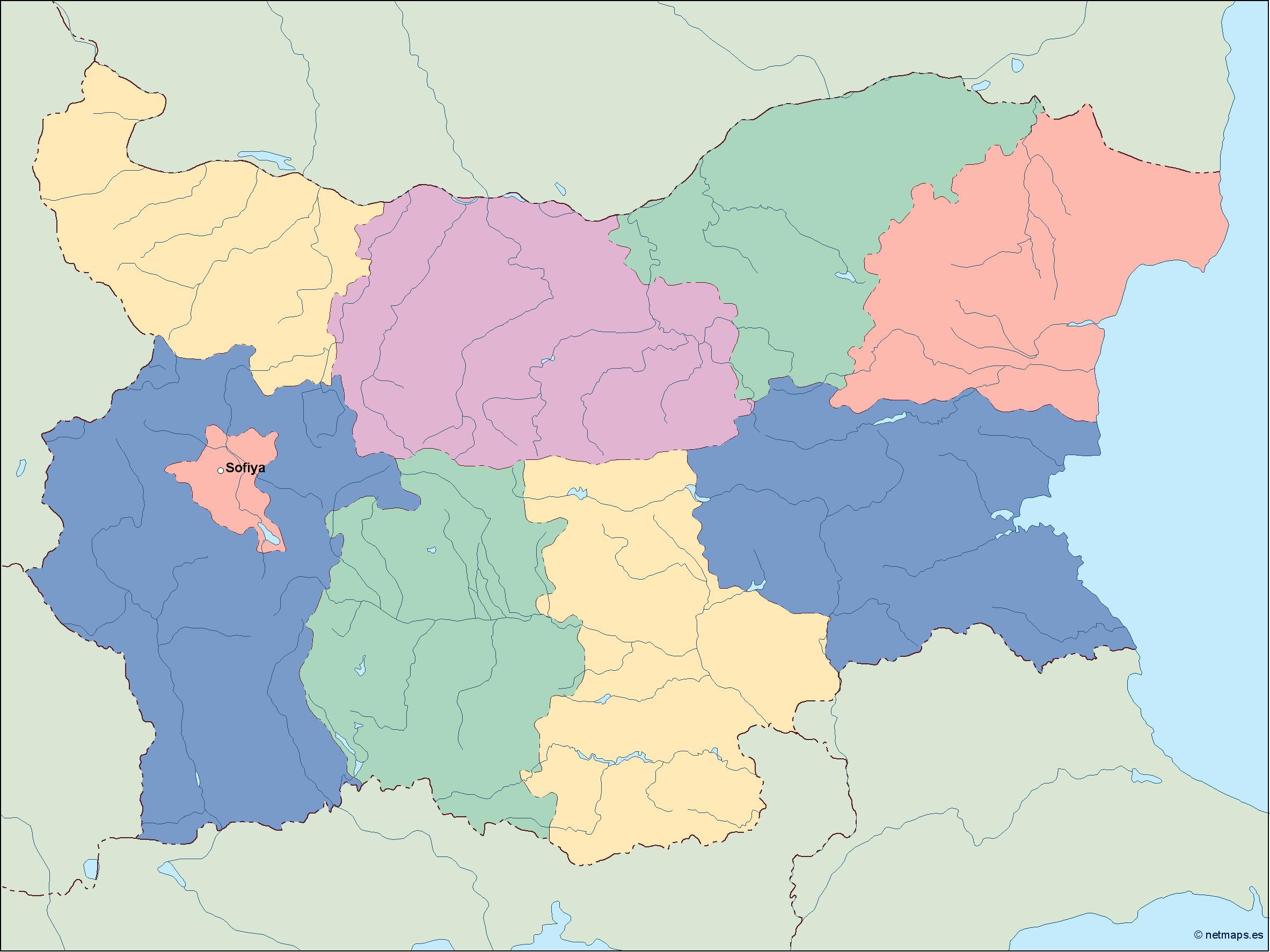
Bulgaria is a country located in Southeast Europe, bordered by Romania to the north, Serbia and North Macedonia to the west, Greece and Turkey to the south, and the Black Sea to the east. Its capital and largest city is Sofia, located in the western part of the country.
The map of Bulgaria in EPS vector illustrator format is a detailed representation of the country’s geography, including its major cities, rivers, mountains, and other important landmarks. The map is designed to be used for a variety of purposes, including educational materials, travel guides, and business presentations.
The map is divided into several regions, each with its own unique features and attractions. The northern part of the country is dominated by the Balkan Mountains, which run from east to west and provide a natural barrier between Bulgaria and its neighbors. The Danube River forms the northern border of the country, and is an important transportation route for goods and people.
Moving southward, the map shows the fertile plains of the Danubian Plain, which is the country’s breadbasket and home to many of its major cities, including Sofia, Plovdiv, and Varna. The southern part of the country is dominated by the Rhodope Mountains, which are known for their rugged beauty and rich cultural heritage.
The Black Sea coast is another important feature of the map, with its long stretches of sandy beaches and popular resort towns like Sunny Beach and Golden Sands. The city of Burgas is the largest city on the coast, and is an important center for trade and tourism.
In addition to its natural features, the map also shows the major transportation routes in the country, including highways, railways, and airports. This information is useful for travelers and businesspeople who need to navigate the country’s infrastructure.
Overall, the map of Bulgaria in EPS vector illustrator format is a valuable tool for anyone who wants to explore this beautiful and fascinating country. Its detailed and accurate representation of the country’s geography and landmarks makes it an essential resource for anyone who wants to learn more about Bulgaria or plan a trip there.
bulgaria vector map. Vector maps from Europe. Illustrator EPS files, fully editable from our european Country map database. All our digital cartography was created with Vector Adobe Illustrator