Description
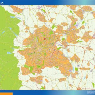
sheffield vector map. Sheffield vector map. Street map of the UK city.
Vector eps City maps of the cities and countries of the world. More than 10 000 vector files

895.00 €
The Sheffield EPS map vector is a detailed map of the city of Sheffield, located in the United Kingdom. The map highlights the main streets and parks of the city, making it easy to navigate and explore.
Some of the main streets that are highlighted on the map include West Street, Division Street, and Ecclesall Road. These streets are known for their bustling shops, restaurants, and nightlife, making them popular destinations for locals and tourists alike.
In addition to the streets, the map also highlights some of the city’s main parks, including Endcliffe Park, Graves Park, and the Botanical Gardens. These green spaces offer a peaceful escape from the hustle and bustle of the city and are popular spots for picnics, walks, and outdoor activities.
Overall, the Sheffield EPS map vector is a useful tool for anyone looking to explore this vibrant city. Its detailed layout and clear labeling make it easy to navigate, while its inclusion of key landmarks and attractions ensures that visitors won’t miss out on any of the city’s highlights.
sheffield vector map. Sheffield vector map. Street map of the UK city.