Description
lithuania vector map. Vlithuania vector map. ector maps from Europe. Illustrator EPS files, fully editable from our european Country map database. All our digital cartography was created with Vector Adobe Illustrator
Vector eps City maps of the cities and countries of the world. More than 10 000 vector files
39.00 €
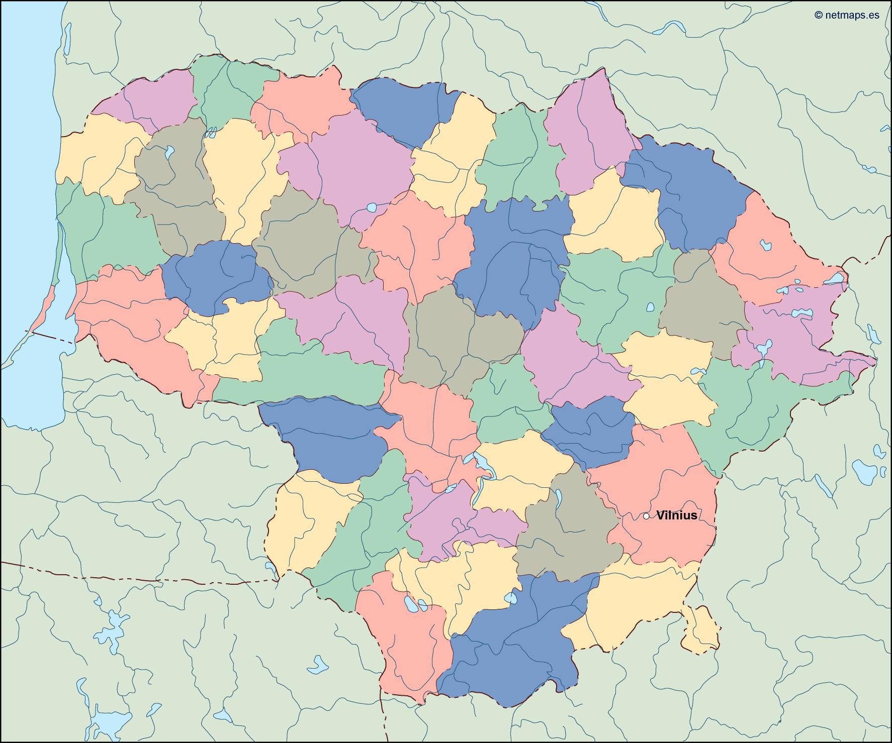
Lithuania is a country located in Northern Europe, bordered by Latvia to the north, Belarus to the east and south, Poland to the south, and the Baltic Sea to the west. The capital of Lithuania is Vilnius, which is located in the southeastern part of the country.
The Lithuania EPS map vector is a detailed representation of the country’s geography, including its major cities, rivers, lakes, and other important landmarks. The map is designed in a vector format, which means that it can be easily scaled up or down without losing any quality.
The map is divided into several regions, each with its own unique characteristics and attractions. The northern part of the country is dominated by the Baltic Sea, which provides a beautiful coastline and numerous beaches. The eastern part of the country is characterized by its vast forests and rolling hills, while the central part of the country is home to many of Lithuania’s major cities and towns.
One of the most prominent features of the Lithuania EPS map vector is the Neris River, which flows through the heart of the country. The river is a major source of water for the country and is also an important transportation route for goods and people.
In addition to the Neris River, the Lithuania EPS map vector also includes several other major rivers, including the Nemunas, the Venta, and the Šešupė. These rivers provide important resources for the country, including hydroelectric power and fishing.
The map also includes several major lakes, including Lake Druksiai, which is the largest lake in Lithuania. The lake is located in the northeastern part of the country and is a popular destination for fishing and boating.
The Lithuania EPS map vector also includes several major cities, including Vilnius, Kaunas, Klaipėda, Šiauliai, and Panevėžys. These cities are home to many of Lithuania’s cultural and historical landmarks, including museums, art galleries, and historic buildings.
Overall, the Lithuania EPS map vector is an essential tool for anyone interested in exploring this beautiful and fascinating country. Whether you are a tourist, a business traveler, or a student, this map will provide you with all the information you need to navigate Lithuania’s geography and culture with ease.
lithuania vector map. Vlithuania vector map. ector maps from Europe. Illustrator EPS files, fully editable from our european Country map database. All our digital cartography was created with Vector Adobe Illustrator