Asia Climate Maps
Our collection of digital maps in Adobe Illustrator EPS format includes a wide range of maps for various countries and regions around the world. One of our most popular collections is our Asia Climate Maps, which provide detailed information on the climate patterns and weather conditions in different parts of Asia.
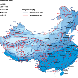
These maps are designed to be highly accurate and informative, providing users with a wealth of information about the climate in different regions of Asia. They include detailed information on temperature, precipitation, humidity, and other key climate indicators, as well as information on important cities and landmarks in each region.
For example, our Asia Climate Maps might include detailed maps of China, Japan, Korea, and other countries in the region, highlighting important cities like Beijing, Tokyo, and Seoul. They might also include information on major landmarks like the Great Wall of China or Mount Fuji, as well as important natural features like rivers, lakes, and mountain ranges.
Overall, our collection of digital maps in Adobe Illustrator EPS format is an invaluable resource for anyone looking to explore and understand the world around them. Whether you’re a student, researcher, or just a curious traveler, our maps can help you gain a deeper understanding of the geography, climate, and culture of different regions around the world.
Showing all 5 resultsSorted by latest
-

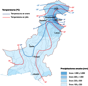
Pakistan Climate eps map vector
65.00 € Select options -

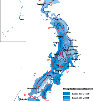
Japan Climate eps map vector
65.00 € Select options -

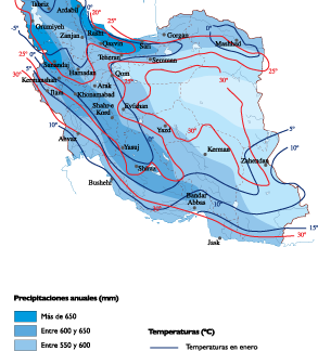
Iran Climate eps map vector
65.00 € Select options -

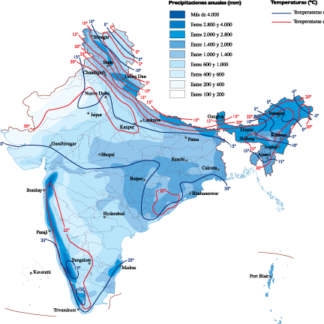
India Climate eps map vector
65.00 € Select options -
China Climate eps map vector
65.00 € Select options
Showing all 5 resultsSorted by latest