Asia Population Maps
Our collection of digital maps in Adobe Illustrator EPS format includes a variety of maps for different countries and regions around the world. One of our most popular collections is our Asia Population Maps, which provide detailed information on the population distribution and density of various countries in Asia.
These maps are designed to be highly accurate and informative, with detailed information on major cities, towns, and other important landmarks. They are ideal for use in a variety of applications, including educational materials, business presentations, and research projects.
Some of the key features of our Asia Population Maps include:
– Detailed information on population density and distribution across the region
– Clear and easy-to-read labeling of major cities, towns, and other important landmarks
– High-quality graphics and design, with a focus on accuracy and detail
– Customizable features, including color schemes and labeling options
Whether you are a student, researcher, or business professional, our collection of Asia Population Maps is an invaluable resource for understanding the complex geography and demographics of this important region. So why wait? Browse our collection today and start exploring the world of digital maps in Adobe Illustrator EPS format!
Showing all 12 results
-

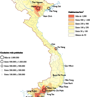
Vietnam Population eps map vector
60.00 € Select options -

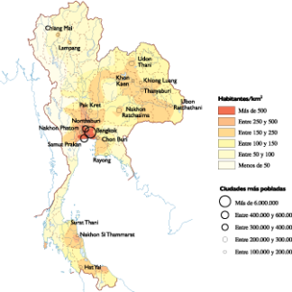
Thailand Population eps map vector
60.00 € Select options -

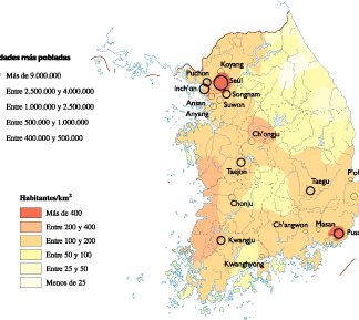
South Korea Population eps map vector
60.00 € Select options -
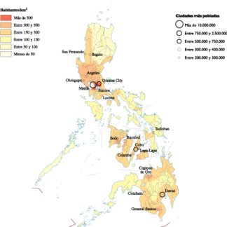
Philippines Population eps map vector
60.00 € Select options -

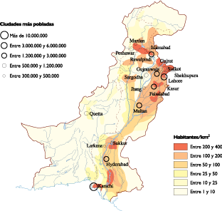
Pakistan Population eps map vector
60.00 € Select options -

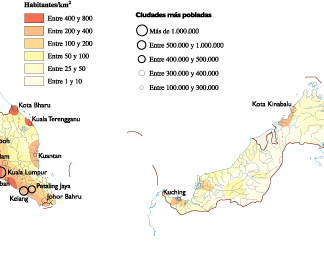
Malaysia Population eps map vector
60.00 € Select options -

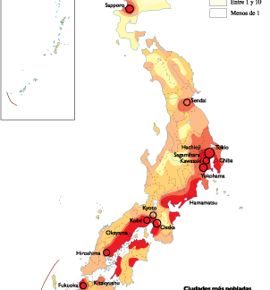
Japan Population eps map vector
60.00 € Select options -

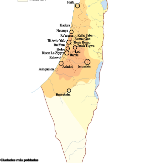
Israel Population eps map vector
60.00 € Select options -

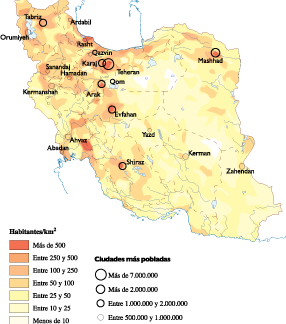
Iran Population eps map vector
60.00 € Select options -

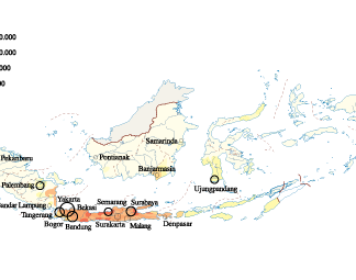
Indonesia Population eps map vector
60.00 € Select options -
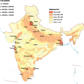
India Population eps map vector
60.00 € Select options -
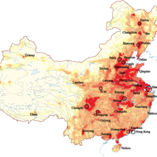
China Population eps map vector
60.00 € Select options
Showing all 12 results