Description
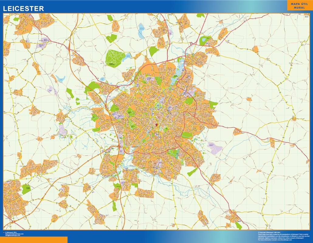
leicester vector map
Vector eps City maps of the cities and countries of the world. More than 10 000 vector files
895.00 €
The Leicester EPS map vector is a detailed map of the city of Leicester, located in the East Midlands region of England. The map highlights the city’s main streets and parks, making it easy to navigate and explore.
Some of the main streets highlighted on the map include High Street, London Road, and Belgrave Road. These streets are home to many of the city’s shops, restaurants, and cultural attractions.
In addition to the streets, the map also highlights some of Leicester’s most popular parks and green spaces. These include Victoria Park, Abbey Park, and Castle Gardens. These parks offer a peaceful escape from the hustle and bustle of the city and are popular spots for picnics, walks, and outdoor activities.
Overall, the Leicester EPS map vector is a useful tool for anyone looking to explore this vibrant and historic city. Whether you’re a local resident or a visitor from out of town, this map will help you navigate Leicester’s streets and discover all that the city has to offer.
leicester vector map