Africa Vegetation Maps
Our collection of digital maps in Adobe Illustrator EPS format includes a variety of maps for different countries and regions around the world. One of our most popular collections is the Africa Vegetation Maps, which provides detailed information on the vegetation and topography of the African continent.
These maps are designed to be used by professionals in a variety of fields, including environmental science, geography, and urban planning. They include detailed information on the location and distribution of different types of vegetation, as well as important cities and landmarks throughout the continent.
In addition to the Africa Vegetation Maps, we also offer collections for other regions, including Europe, Asia, and the Americas. Each collection includes a variety of maps that provide detailed information on the geography, topography, and cultural landmarks of the region.
All of our maps are designed to be easy to use and customize, with editable layers and vector graphics that can be easily modified to suit your needs. Whether you’re a professional cartographer or just looking for a high-quality map for your next project, our collection of digital maps in Adobe Illustrator EPS format is the perfect choice.
Showing 1–16 of 53 results
-

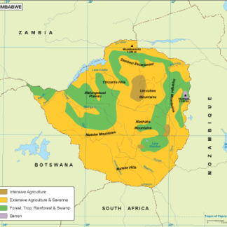
Zimbabwe vegetation eps map vector
70.00 € Select options -
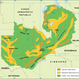
Zambia vegetation eps map vector
70.00 € Select options -

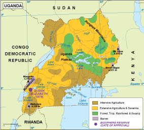
Uganda vegetation eps map vector
70.00 € Select options -

Tunisia vegetation eps map vector
70.00 € Select options -
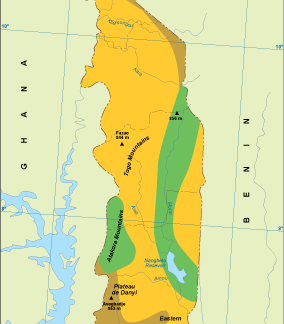
Togo vegetation eps map vector
70.00 € Select options -
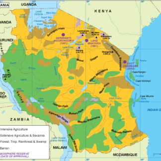
Tanzania vegetation eps map vector
70.00 € Select options -

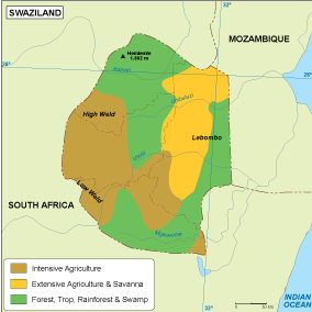
Swaziland vegetation eps map vector
70.00 € Select options -
Sudan vegetation eps map vector
70.00 € Select options -
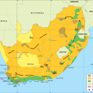
South Africa vegetation eps map vector
70.00 € Select options -
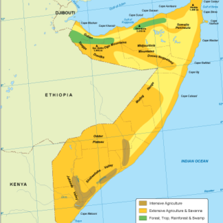
Somalia vegetation eps map vector
70.00 € Select options -
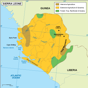
Sierra Leone vegetation eps map vector
70.00 € Select options -
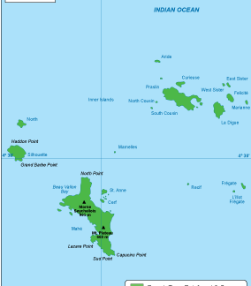
Seychelles vegetation eps map vector
70.00 € Select options -
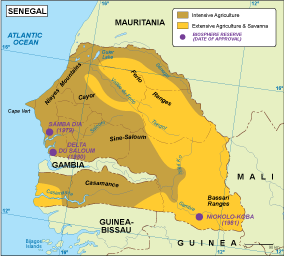
Senegal vegetation eps map vector
70.00 € Select options -
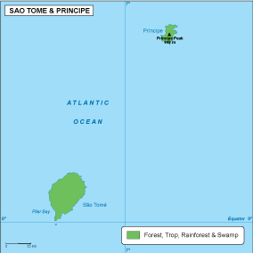
Sao Tome e Principe vegetation eps map vector
70.00 € Select options -

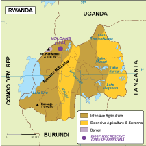
Rwanda vegetation eps map vector
70.00 € Select options -
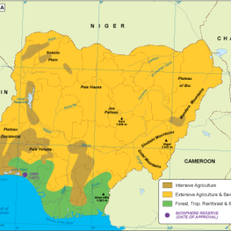
Nigeria vegetation eps map vector
70.00 € Select options


Showing 1–16 of 53 results