Africa
EPSMaps.com offers a wide range of digital map collections for businesses in Adobe Illustrator EPS format. These maps are designed to provide accurate and detailed information about various countries and regions around the world. Our maps are perfect for businesses that require precise location data for their operations.
Our collection of maps for Africa includes detailed maps of all the countries in the continent. These maps provide accurate information about the location of major cities, towns, and landmarks. They also include information about the topography of the region, including mountains, rivers, and other natural features.
In addition to providing detailed information about the geography of Africa, our maps also include important information about the political situation in each country. This includes information about the current government, political parties, and other important institutions.
Our maps are designed to be easy to use and customize. They can be easily edited in Adobe Illustrator, allowing businesses to add their own branding and other information to the maps. This makes them perfect for use in presentations, reports, and other business materials.
Overall, EPSMaps.com offers a comprehensive collection of digital maps for businesses in Africa and around the world. Our maps are accurate, detailed, and easy to use, making them an essential tool for any business that requires precise location data.
Showing all 3 resultsSorted by latest
-

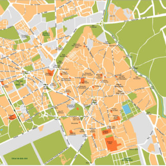
Marrakech Illustrator eps map vector
160.00 € Select options -
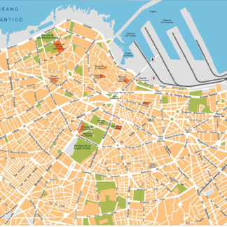
Casablanca Illustrator eps map vector
160.00 € Select options -
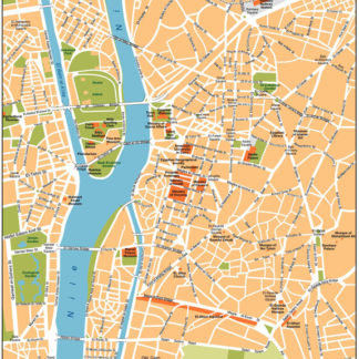
Cairo Illustrator eps map vector
160.00 € Select options
Showing all 3 resultsSorted by latest